- Teacher: Ruth nyanduko
West Mugirango Technical and Vocational College
-
Welcome to your new Gnomio site
Now, you are in control!
Moodle is an open-source Learning Management System (LMS) that provides educators with the tools and features to create and manage online courses. It allows educators to organize course materials, create quizzes and assignments, host discussion forums, and track student progress. Moodle is highly flexible and can be customized to meet the specific needs of different institutions and learning environments.
Moodle supports both synchronous and asynchronous learning environments, enabling educators to host live webinars, video conferences, and chat sessions, as well as providing a variety of tools that support self-paced learning, including videos, interactive quizzes, and discussion forums.
You can edit or remove this text)
Available courses
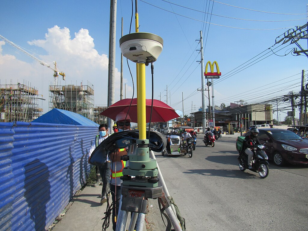
Cartography is the science and art of making maps. It involves gathering, analyzing, and interpreting geographical data to represent the Earth's surface accurately. Here’s what cartography entails:
1. Data Collection
- Gathering geographical and spatial data from sources like satellite imagery, GPS, aerial photography, and field surveys.
- Using Geographic Information Systems (GIS) to analyze and process spatial data.
2. Map Design & Representation
- Selecting map elements such as scale, symbols, colors, and labels.
- Choosing the appropriate projection method to reduce distortions in representing the Earth's curved surface on a flat map.
- Using cartographic principles to ensure clarity, accuracy, and readability.
3. Map Production & Technology
- Traditional hand-drawn maps vs. digital cartography using software like ArcGIS, QGIS, and AutoCAD.
- Printing maps or creating interactive and web-based maps for navigation and geographic analysis.
4. Types of Maps
- Topographic Maps – Show natural and man-made features with contour lines for elevation.
- Political Maps – Highlight boundaries, cities, and administrative divisions.
- Thematic Maps – Represent specific themes like population density, climate, or land use.
- Navigational Maps – Used for aviation, marine, and road navigation.
5. Interpretation & Application
- Used in urban planning, environmental management, transportation, military strategy, and disaster response.
- Helps in visualizing spatial relationships, making geographic decisions, and studying trends over time.
- Teacher: Ruth nyanduko